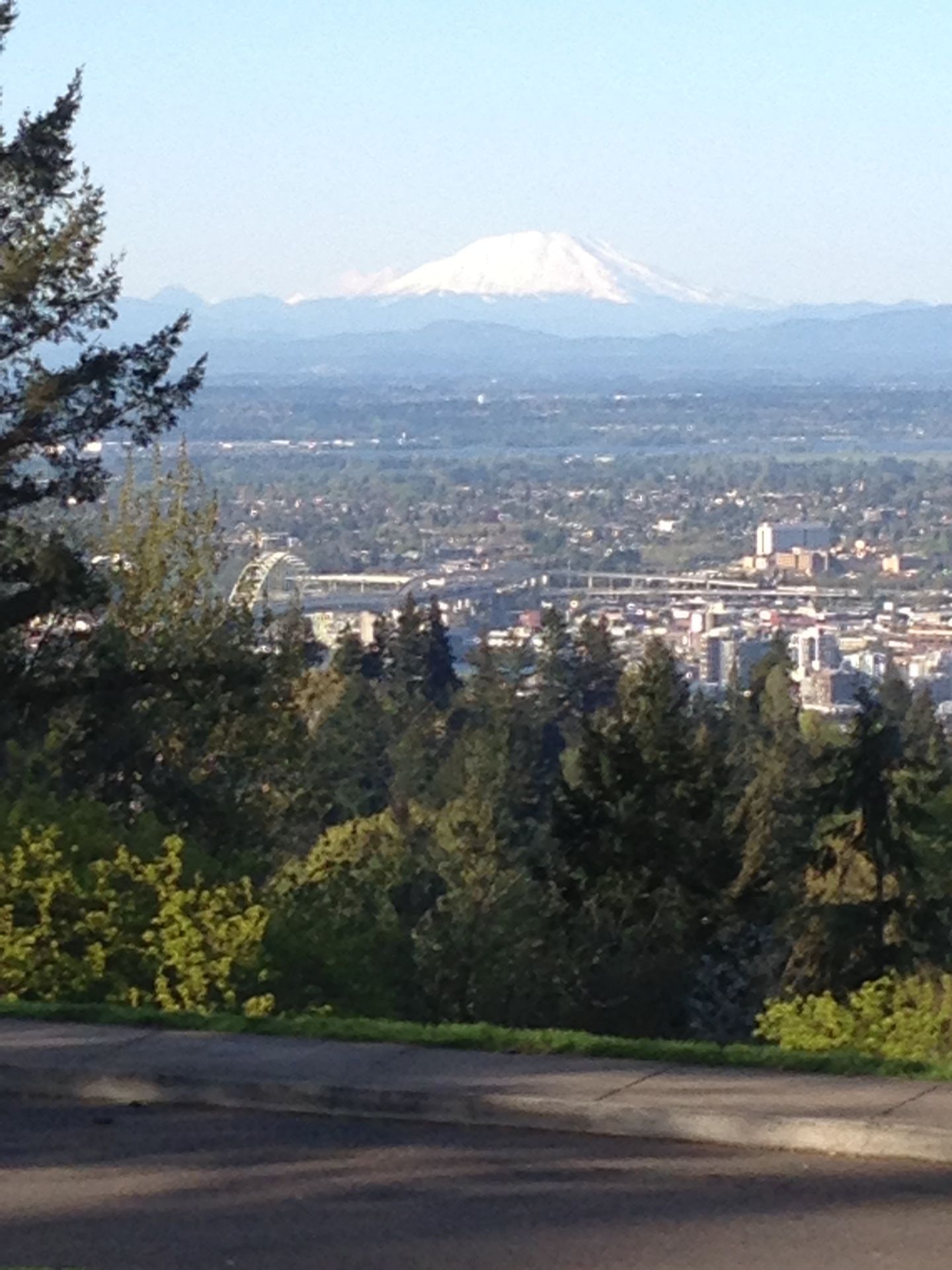
Council Crest, rising 1,073 feet above sea level, reigns as Portland’s highest point. This peak offers breathtaking panoramic views and a fascinating history, evolving from a bustling amusement park to a tranquil urban oasis. Whether you’re drawn to its stunning vistas, its intriguing past, or its network of hiking trails, Council Crest promises a rewarding experience.
Unveiling Portland’s Panoramic Peak
From the summit of Council Crest, a breathtaking panorama unfolds. On a clear day, your gaze can sweep across five majestic Cascade peaks, including Mt. Hood, Mt. St. Helens, and possibly even Mt. Rainier. The Willamette and Columbia Rivers wind through the landscape below, while the city of Portland stretches out to the horizon. This remarkable vantage point encompasses approximately 3,000 square miles, a testament to the peak’s commanding height.
Delving into the Crest’s Rich History
Council Crest’s story adds another layer of intrigue to its natural beauty. From 1907 to 1929, this tranquil peak was home to the Council Crest Amusement Park, a bustling hub of entertainment. Imagine roller coasters rattling along the ridge, the joyous shrieks of children echoing through the air, and the aroma of popcorn and cotton candy wafting on the breeze. Remnants of this bygone era, such as the old bronze fountain, can still be found within the park’s 43.51 acres, offering glimpses into a vibrant past.
Debunking the Myth of the Name
The name “Council Crest” often evokes images of Native American councils gathering at the summit. This romantic notion, while widely circulated, is likely more legend than historical fact. Some experts believe the name originated from the summit’s resemblance to a council house, rather than documented Native American gatherings. This intriguing misconception adds a touch of mystique to the park’s legacy. “It was an unproven belief that the park site had been a traditional council ground for Native American Indians; therefore, the name ‘Council Crest,'” according to pdxhistory.com. Ongoing research continues to explore the area’s history, and new discoveries may yet shed light on the true origins of the name.
Exploring Council Crest Today
Today, Council Crest Park offers a diverse range of recreational opportunities. Hikers can choose from a variety of trails, from the challenging Marquam Trail to the more leisurely Talbot Trail. Dog walkers can let their furry friends roam free in the designated off-leash area, while those seeking a relaxing afternoon can enjoy a picnic amidst the natural beauty. The park also features public art installations and a reservable wedding site, nestled among the trees.
Hiking Trails to the Summit
Council Crest offers a variety of trails for hikers of all levels:
- Marquam Trail: This strenuous 2.7-mile trail boasts an elevation gain of approximately 745 feet, offering a challenging but rewarding climb with stunning views.
- Council Crest Trail: A moderate 1-mile hike with an elevation gain of roughly 440 feet, this trail provides a good workout while showcasing the surrounding scenery.
- Talbot Trail: This easy 1.2-mile trail, with an elevation gain of approximately 270 feet, is perfect for a leisurely stroll through the park’s diverse flora and fauna.
Remember to check recent trail reports and come prepared with appropriate gear, including water and snacks.
Reaching the Crest: Your Transportation Options
Getting to Council Crest is easy, with several transportation options available:
Driving
Simply enter “Southwest Council Crest Drive, Portland, OR 97201” into your GPS. Parking is available at the top, but be aware that the gates close at 7 pm between November 1st and March 31st due to potential winter weather conditions.
Biking
The Marquam Trail offers a direct route to Council Crest for cyclists. Be prepared for a steep climb, but the breathtaking views are well worth the effort.
Public Transportation
Take a bus or other form of public transit to a stop near the park entrance or a convenient trailhead. From there, you can hike or bike the remaining distance to the crest.
Hiking
The Marquam and Shadyside Trails offer scenic hikes to Council Crest, providing a chance to immerse yourself in the natural beauty of the Tualatin Mountains (also known as the West Hills).
Council Crest at a Glance
- Elevation: Approximately 1,073 feet (some sources mention 1,071 feet).
- Location: Nestled in Southwest Portland, Oregon, within the Tualatin Mountains (West Hills), running parallel to the Willamette River.
- Historical Names: Talbot’s Mountain, Glass Hill, Fairmount
- Wedding Site Reservations: 503-823-2525
Tips for Your Visit
- Best times to visit: Early mornings or evenings for optimal lighting and fewer crowds.
- Essentials: Bring water, snacks, and appropriate clothing for varying weather conditions.
- Safety: Check the weather forecast and be aware of seasonal gate closures.
Whether you’re seeking panoramic views, a challenging hike, or a glimpse into Portland’s history, Council Crest offers a unique and rewarding experience. It’s a testament to the city’s blend of natural beauty and urban charm. If you’re interested in creating your own unique living space, consider exploring container homes plans or container house plans for inspiration.
- How to Get Rid of Mushrooms in Your Lawn: A Complete Guide - April 24, 2025
- How to Get Rid of Ground Hornets: A Safe and Effective Guide to Eliminating Nests - April 24, 2025
- How to Get Rid of German Roaches Fast: DIY Methods for Quick Control - April 24, 2025


